One Swedish Summer
  • My Blog
    • About Me
My Gronabandet Summer 2013

Wilderness Walking In Northern Places

'there is nothing like a wilderness journey for rekindling the fires of life. Simplicity is part of it. Transportation reduced to leg - or arm - power, eating irons to one spoon. Such simplicity, together with sweat and silence, amplify the rhythms of any long journey, especially through unknown, untattered territory. And in the end such a journey can restore an understanding of how insignificant you are - and thereby set you free' (Colin Fletcher)
Picture

gronabandet stage 4 (A) (kungsleden alternative)

14/1/2013

 
Picture
I have spent an enjoyable evening looking at maps and working out the route from Hemavan to Abisko (Stage 4). The obvious route is the Kungsleden, around 450 kms of world class trail through raw wilderness. Having walked over half of it already I know how good it is. It is now some years ago, walking from Abisko to Kvikkjokk on the Kungsleden (ie half) in the 'stupidly fast' time of seven days, that I fell in love with backpacking/wilderness walking. Despite finishing with tattered feet (very traditional 'Lundhags' boots in hot weather) and totally exhausted I've kept on coming back for more. Older and wiser I've slowed down and enjoy the view a bit more. It was pure vanity to think that wilderness or mountains can be 'conquered'.

Picture
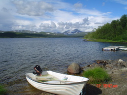
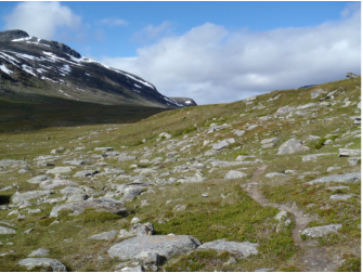
I am considering an alternative route to the Kungsleden and that will take me through country I've always had an eye on. Whilst the Kungsleden from Tarnasjo (the third hut from Hemavan, a lovely lakeside spot, as pictured here) heads about fifty kms east and north from there to Kvikkjokk and the eastern side of Sarek), there is an alternative route north. I've mapped out a route that hugs the Norwegian border for a couple of days and then breaks cross country (no trail, some wild walking but a good river to 'handrail' until I reach Laisstugan) meeting the next trail which will take me to my one and only supply point, Vuoggatjalme, before Abisko around 8 days later.

Picture
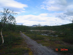
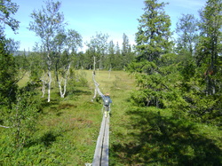
This choice covers in part some trail I've walked before. The first part is known to me from several years ago (bridge near the Sami settlement of Dalavardo pictured, that village was deserted in the summer, though I felt 'observed' as I walked through it). Thereafter, until the hut at Pieskehaure, it's new. The advantage on this section, as opposed to the Kungsleden, is that there are fewer lakes. Mavas (the map hints of an intriguing semiphore system to, no doubt, summon a lift from the Sami village opposite - I've subsequently checked online since writing this and there are two semiphore posts with boats at around 300/400 kr) and Vaisa present the two departure points, on the Kungsleden there are considerably more. Pieskhaure north is very familiar as I wandered down this way in the summer. Padjelantaleden (a route that I love for the big lakes and far reaching views across to the snow capped Norwegian mountains of Rago, also the birch forests to the north) will take me to Vaisa and then the boat to Ritsem (I miss also the stretch of road from Kebnats west if I was on the Kungsleden route). Another resupply at the Ritsem 'fjallstation' and then the Nordkalotleden branching off to meet the Kungsleden around Salka and then north to the sophisticated delights, hot water and a restaurant, of Abisko. 'All-in-all' a two week route from Hemavan.

A very good site detailing the author's walk from Pieskehaure to Abisko is www.nielsenbrownoutdoors.com/. There is an amusing and interesting narrative with some fine photographs.

I've even considered an alternative from Dalarvado to Pieskehaure through Norway. As I have the Norwegian map for Saltfjellet I can see a route for several days on the Norwegian side of the border to the small village at Sulitjelma. It's got potential and Sulitjelma, somewhere I've passed through twice exiting the wilderness and heading home to Britain, has the advantage of a good supermarket (a 'Konsum'). That's the beauty of the 'gronabandet', total flexibility in route choice.

Picture
I need to now map out the Kungsleden route from Hemavan to Abisko and consider the merits. There will be a single trail with more opportunity for supply, not least at Kvikkjokk and Salto (a favourite place of mine particularly the excellent 'fjallstation' restaurant). The walk from Kvikkjokk north is good, skirting Sarek, and I have happy memories of it. I love the mouth of the Rapadalen with the forests, water and mountains creating a real spectacle. Lake crossings though could slow things down considerably. I need to either row the rowing boats provided on the trail (see my earlier post on the 'Roddled') or pay the Sami to ferry me across. The advantage is that the trail from Tarnasjo to Kvikkjokk is all new to me and I have heard it's very good indeed. It would be something, of course, to walk the whole of the Kungsleden in one go.

Two further observations. I am looking at upgrading some of my 'rather ancient' Lantmateriet Fjallkarta to their Calazo equivalents (I bought the Calazo Padjelanta/Sarek sheet this summer, same survey but two maps on one sheet and both tougher and lighter). Secondly, I note now how provisional this list is and will fine tune it over the months. I need, not least, someone to take my boxes in for me.

DAY

30
31
32
33
34
35
36
37
38
39
40
41
42
43
44

DESTINATION

Tarnasjon
Dalavardo
Sarvesjaurek
Laisstugan (via Glibbokatan)
Vuoggat'lme (Supply Box)
Ikesjaure (via Mavas)
Pieskehaure
Stalo'
(Wild Rest Day)
Kutjaure
Ritsem
Hukejaurestugan
Tjakktastugan
Abisko
(Rest)
MAP

AC2
AC2
BD15
BD15
BD14
BD14
BD9
BD9
BD9
BD9
BD9
BD7/BD6
BD6
BD6

gronabandet stage 3 - sweden's backcountry

12/1/2013

 
Picture
This is the stage that I am looking forward to most, a difficult part of Sweden's mountain system to reach in ordinary circumstances and a world away from the ease and popularity of the northern Kungsleden in the busy high season months of July and August. I'll be leaving Jamtland and crossing into Lapland on some tempting trails, many served by quiet huts off the main STF network. There's a section or two 'off trail' as well and only a little road before Hemavan. This is what I want from the Gronabandet though, the opportunity to walk in quiet 'backcountry' and to really get to know Sweden's trails. I'll also be mindfull of what I am passing, areas I have always had an eye on such as the Norwegian wilderness of 'Borgefell' and also Swedish 'Marsfjallen' (a Swedish mountain guide once told me one stormy night beside the roaring stove in the 'sakerhets' room at off season Helags that in his opinion this was the best area in Sweden).

I've put together a provisional list and it's in this stage that there is the most opportunity for choice and variation of route. This route, I think offers the most natural south to north bearing. I may end up walking something different, I don't know. The Army saying that 'a battle plan doesn't survive first contact with the enemy' might run true here. Planning on a route on a Saturday evening on the sofa at home, whilst the wife half watches a crime drama, feels a little artificial.

The end of this stage is of course Hemavan and the start of the Kungsleden. I've been here before so will know my way on from the small town. I will walk through the southern portal of the Kungsleden and will expect to arrive in Abisko perhaps three weeks later (at the northern end). Hemavan is well served so will be a good town stop. If I need any gear I may have to think about Tarnaby as there is the well known 'Tarnaby Fjallsport' shop there. Its a long way to restock anywhere after that.

DAY

20
21
22
23
24
25
26
27
28
29
DESTINATION

Blerikfjallet
Sielkentjakkstugan
Sodra Borgafjallen
Klimpfjall (Supply Box)
Tjakkelestugorna
Atnikstugan
Arevattnet
Atostugan
Hemavan
(Rest Day - Supply Box Hemavan)
MAP

Z1
Z1
Z1
Z1/AC4
AC4
AC4
AC4
AC2
AC2

Gronabandet stage 2 - supplying from the uk

12/1/2013

 
Picture
I've set out a preliminary Stage 2. This will take me through the central part of Jamtland and is perhaps the least attractive of the route. The fells flatten out a little here and the landscape is dominated by very large lakes (that require walking around) and some forest. Most of the going is on quiet tracks and byways with the occasional trail. That said it's still very wild land and there is plenty of opportunity for quiet camps.

I think this part of the route will be set as standard for most challengers. The boys over at Le Trek have got this down and it's the route that Lars Wessell and the amusing 'Tanterna pa Tur' (I like their anarchic attitude!)  followed on their completion. The goal is to get to Gaddede, things become a lot more interesting after that (see my post 'Sweden's Secret Trails).

I have now decided to sort my supply boxes out here in Sussex and mail them from the UK (perhaps 10 in total). I was thinking about getting everything to Stockholm and doing it from there. My wife reminded me about the costs of postage in Sweden and I got thinking. I can get a box picked up from my door and sent to a supply point for about £20 a box. Sounds expensive and it is. It's more expensive than the cost of flying to Sweden and back from Norway, that's only £100. The balance is that with the weakness of sterling and the relatively high cost of food in Sweden (nothing compared to Norway though) it will be cheaper to get all the things I want/like sorted here and mailed out. I will be running on 'malt loaf' consequently!

I've scheduled a wild rest day in. They are some of the best sometimes. Usually kicked off by waking up to heavy rain on the flysheet and deciding not to move on!

DAY

9
10
11
12
14
14
15
16
17
18
19
DESTINATION

Rest Day Duved (Supply Box)
Smedjeviken (Kallsjon)
Grasjon
Bergsjon
Jansmassholmen
Rorvattnet
Vals'byn (Shop Rotviken)
Lobbersjon
(Rest Day - 'Wild')
Haggnaset
Gaddede (Supply Box)
MAP

Z7/Z5/Z4
Z4
Z5
Z5
Z5
Z5
Z5
Z5
Z5
Z5
Z5

Gronabandet - stage 1 

5/1/2013

 
Picture
I've put together my preliminary plan for the first stage of the walk. This will take me from the start at Grovelsjon and through to Duved where I should enjoy my first rest day (naturally foul weather might add a day and I am thinking of having a few 'weather days' to play with on the walk).

I am really looking forward to this stage for a number of reasons. I've yet to visit Dalarna, a county core to the Swedish cultural identity in many ways (think the horse figurine of the 'Dalar hast' in 'Gamla Stan'!). Grovelsjon lies on it's northern border and from there it's through to Rogen. Again Rogen has been on my list for a while due to the alluring combination of lakes, forest and low fells.

From Rogen I get the opportunity to wallow in nostalgia. My wife and I spent our honeymoon at the Fjallnas 'mountain lodge' and its here that I fell in love with 'fjallen'/the Swedish mountains. We enjoyed good food and comfortable beds with some fantastic walking on the doorstep. I'll get to revist some of the places we spent some time. After Rogen I have the option at a trail fork of heading across the Norwegian border and up the southern flank of the Norwegian mountain of Storvigelen. This lies at around 1500 metres high and when my wife and I 'summited' I was quite taken with the extensive views, particularly towards Helags/Sylarna. Alternatively, I could proceed around the north western side of the mountain (the second option on the fork after Rogen) and visit Fjallnas' mountain hut where we enjoyed some quieter days just relaxing (see their site http://www.fjallnas.se/en/activities/hiking/ - hut pictured and it's a great camping spot) . I need to contact Fjallnas and ask them for permission to use their boat to cross the lake just before the hotel. I would also like to pick up my first box there which means I should have a very light start with only three days food carried initially.

From there I will head into the classic Jamtland area and again will wallow in nostalgia. I lived in Sweden for a short period and enjoyed some very quiet off-season walks in an October which saw no snow. I had the whole 'Triangle' to myself which was amazing. Visiting the 'closed-up' 'fjallstationer' of Sylarna and Helags was an intriguing experience. Quite a contrast to the busy summer period. Since then I have been back with my family. Above is a picture of my son, then four, enjoying his first four day backpack in Jamtland dressed Swedish 'vandring' style (by his Swedish mother naturally) in 'gummistovlar' and with a Fjallraven 'kanken' on his back.

Perhaps some lunch at Valadalen and then some 'bushwhacking' to Duved. That last day looks fairly difficult (I won't have to worry about bears as per two years ago in the Yukon) but inevitable. Lars Wessell's blog has forewarned me but I want to get to Duved.

For some time I played with the idea of heading out of the 'Triangle' area to Storlien and north from there as there is some good country on both the Swedish and Norwegian side. With another two weeks to play with that would be probable but I just don't have it. I suppose the ideal trip might be a three month one finishing some time in mid-September after a mid June start. However, what I don't visit is something to go back for of course!

My provisional 'Stage 1' itinerary is listed below (with apologies for the anglicisation). I attach two PDFs. One is of the Jamtland Triangle (thank you STF!) and the other of the Lantmateriet Fjallkartor which gives sense of the ground covered and refers to the maps in my table. I need to relish 'Stage 1' as the next stage is a little more mundane!


storlienvaladalenljungd.gif
File Size: 136 kb
File Type: gif
Download File

100kfjallkartan.jpg
File Size: 149 kb
File Type: jpg
Download File

DAY

1
2
3
4
5
6
7
8
9
DESTINATION

Sarsjobacken
Rogenstugan
Bolagen/Fjallnastugan
Longbrottstugan (Supply Box)
Faltjagstugan
Ljungen
Valadalen/Ottfjallet
Duved
(Rest Day Duved)
MAP/FJALLKARTAN

W1
W1/Z8
Z8
Z8
Z6
Z6
Z7
Z7

journey's end/resolution

2/1/2013

 
Picture
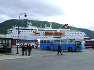
Perhaps it was the inevitable return to the grinding routine of work today but I spent an idle moment at lunch considering the finish of my Gronabandet later in the year and my journey from the 'end terminus' of Treriksroset back to Britain. Within 30 minutes, rather unbelievably, I had booked a direct flight in the last week of August on 'Norwegian' from the Norwegian sub-arctic city of Tromso back to Gatwick for a mere £60. I then searched the internet for the bus from Kilpisjarvi, in Finnish Lapland, to Tromso and with an email from 'esk.lapinlinjat@co.inet.fi' the bus company confirmed that they pick up from the small hotel in Kilpisjarvi at around 5 pm and arrive in Tromso at 7.30 pm. Kilpisjarvi is a couple of hours easy walk from Treriksroset and it's ground I covered (albeit in the opposite direction with the bus from Tromso, pictured) some years back.

With my flight not until 9.15 pm, I realised that it was entirely possible to have my hand on the border stone, finishing the Gronabandet, and within around twelve hours walk through my own front door in southern England. A giddy prospect that I think my head will spin a little from, swapping two months of northern trail for my own quiet street in such a short period of time. I think I will need a little bit of space to decompress and, also bearing in mind the bus from Kilpisjarvi travels a long way to get there and could be subject to delay, consequently will book a night's accomodation in Tromso. Perhaps I should also start saving up as well for the considerable cost of a meal out in Norway (!).

Picture
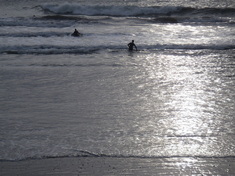
I spent the new year bank holiday in the English coastal county of Devon and managed to get some walking in. It was a little wet with some strong winds but surfers seemed to enjoy it. For me the arrival of 2013 means my preparations need to step up. I think I will work back from my now confirmed end date and set my start date fairly shortly. I'm thinking of around 55 days which gives me a little time to play with but not much (Lars Wessell's inaugral crossing was 52 days with few rest days but a notable combination of some 'big mileage' days and much shorter days (see his interesting blog http://www.larswessel.se/%C3%A4ventyr/fj%C3%A4llkedjan-1549155 which is in Swedish; very informative and some good themes of people he met and food!)).

Picture
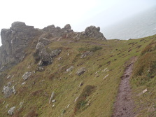
Some good walking on the South West coastal path allowed me to burn off some of the Christmas excess. I've resolved as well not to drink alcohol for January which should help me prepare for the Gronabandet as well, I suspect that most of that will be dry and I will have to forego my usual GSI hipflask of single malt. I tried out my new aluminium Pacerpoles, kindly donated to me by Pacerpoles Heather Rhodes, and these proved as good as the lighter (albeit more fragile) carbon Pacerpoles that I have used succesfully for several years in some testing conditions. I need to post in more detail on them shortly as I've a lot to say on this key piece of kit. It's the sort of innovative British kit that I am pleased to use.

Of note as well is some late night listening. I've tuned in to the enjoyable reading on BBC Radio 4 of   'Wild', an account of a Pacific Crest Trail hike by Cherl Strayed (http://www.bbc.co.uk/programmes/b01pkkr7). It's described as 'Cheryl Strayed's redemptive account of hiking 1100 miles alone through  America's rugged western landscape. At twenty-six Cheryl Strayed thought she'd  lost everything after her mother died, and her marriage crumbled. With no previous experience of backpacking, she made the impulsive  decision to rebuild her life by setting out on an incredible journey  along America's Pacific Crest Trail.' It's a good listen and reminds me of why I want to do the Gronabandet and what I need to do both now and along the way.

Sweden's secret trails - The 'southern kungsleden'

24/11/2012

 
Picture
There's a lot of walking in Sweden's mountains and this week I've found a feast of hidden trails and tucked away huts! Thanks to a quick and easy order of the missing map 'Z7 Are'  from 'The Map Shop' (see their site for details http://www.themapshop.co.uk) I now have the complete set of maps for my potential Green Band route.

I've spent a few hours consequently with my eye sweeping the Harjedalen/Jamtland end of the route (essentially the first half) and it's been an interesting exercise. Firstly, it's confirmed my suspicion that from about Are/Duved to Gaddede (a couple of hundred kilometers) I've got some long days of grinding out distance on endless stretches of quiet forestry roads and there isn't really much alternative. At least resupply should be easy at this point as there are villages only a few days apart. However, for someone who thought he knew Sweden's mountains fairly well I've been delighted at finding some very long trails through remote parts of the mountain chain. These are probably well off most people's radar and will offer a more solitary experience than the potentially busy northern section of the Kungsleden.

The 'Kungsleden' ('Kings Trail') probably needs little introduction to most people with an interest in hiking. You've probably at least heard of it somewhere if not, indeed, contemplated walking it. It pops up even in popular travel features as a 'wilderness adventure' and travel journalists from all over the world, quite rightly, gush over spending four or five days walking one of it's northern sections (typically the northern Salto to Nikkaluokta or from there to Abisko). It's got the assurance of serviced STF huts along the way and is consequently popular in the summer months (the STF site explains more (http://www.svenskaturistforeningen.se/en/Discover-Sweden/Facilities-and-activities/Lappland/kingstrail/?intro=false)).

I've walked about three quarters of it myself though arguably it's most interesting mid-sections are unknown to me (Ammarnas to Kvikkjokk). Here is the part of the trail less visited due to the absence of huts etc. along the way and I'll look forward to it. What's been exciting though this week is the discovery of new areas of the mountain chain much further south in Jamtland and the border with Lapland and the realisation that I can link some pretty remote trail networks to get myself north from the small village of Gaddede to the start of the 'Kungsleden' at Hemavan (where from if I choose with the 'Kungsleden and/or Padjelantaleden plus the 'Troms Border Trail' north of Abisko it's good trail all the way to my destination at Treriksroset).

Good examples of the potential for using some of Sweden's 'secret trails' are found on the two maps of Z1 (Stekenjokk) and neighbouring Z2 (Borgafjall). I've got a menu of routes across quiet mountains such as 'Borgafjallen' or 'Ovredahke' and potential stays in no doubt lonely huts such as Sielkentjakkstugan. This is prime fishing country and I will no doubt meet Swedes or Norwegians on a 'fisketur'. That's a practice I've always admired, that of wandering the hills with a telescopic rod with the prospect of fresh mountain char over a fire. I'll enjoy this part of Jamtland I am sure. The route in to Hemavan or Tarnaby looks good too further north and there are a number of options (see AC4 Fatmomakke).

Ultimately this is the stated aim of the organisers of the Green Band, to spread awareness of the Swedish Mountain chain in its entirety not just the parts with an international reputation. Less known internationally are the areas on the southern end of the Swedish mountains. I've only been as far south as Fjallnas so I am looking forward to the first few days from Grovelsjon through Rogen and then up over perhaps a week to Helags and the classic 'Jamtland Triangle' (much loved by me and an area I've backpacked with my young children). The southern area south of Helags is largely unknown to me and I want to go back, when I am done, and explore south of Grovelsjon and into the more forested areas of Dalarna where low fells break like islands in a sea of trees. Here lie habitats for bear, wolves, elk and other boreal creatures.

I found the below PDF and it's worth a read. I think it demonstrates the point that there really is a lot of walking in Sweden's mountains and some parts perhaps deserve an enhanced reputation. Some in Sweden talk of a 'Southern Kungsleden', more of an idea than a trail of international reputation. It's interesting to note that authorities in the 70's talked of a single 'Kungsleden' stretching for hundreds and hundreds of miles from the forest of Dalarna to the tundra of northern Lapland. On this 'secret trail' of the 'Southern Kungsleden' there would no doubt be plenty of quiet walking and an abundance of flora and fauna, for me it's got an air of romance to it. I'll put it on  the 'to-do' list which has grown quite a bit this week!


sodrakungsled-eng.pdf
File Size: 2587 kb
File Type: pdf
Download File

'Roddled' - 'Grizzly bears and razor clams'

6/11/2012

 
Picture
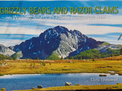
I am nearly at the end of Chris Townsend's 'Grizzly Bears and Razor Clams' which describes his summer long walk of the 1200 mile Pacific Northwest Trail which runs through the Rocky Mountains to the Pacific Ocean through the states of Montana, Idaho and Washington. Like most UK backpackers, I would imagine, I consider Chris' features in TGO magazine to be one of it's highlights. His books are very readable, informative and entertaining and thanks to his 'Walking the Yukon' book I got myself out there last year and had a very memorable wilderness walk on my own over the 'Donjek Route'. 'Grizzly Bears' is very much improved by it's format, one that includes many of his excellent photos.

Anyways, this isn't a review as such rather I was struck by his discussion of crossing water in long hikes and the problems that it might bring. I must admit I have been mulling over the challenge on my 'Gronabandet' of crossing the big lakes in Swedish Lapland. My intention is to pick up the famous Kungsleden at Hemavan and follow it to it's conclusion some 450 kms later at Abisko. It's 'middle third' from about Ammarnas to Kvikkjokk sees the crossing of about five large lakes. These are described as 'roddled' ('row paths'). The Swedish local authorities or the STF maintain a number of rowing boats which can be used by walkers to row across the lakes. There is an etiquette of always ensuring there is at least one boat at either end of the 'roddled'. Typically there is three on each 'roddled' which means that if at your end there is only one and you take it then you need to take the spare from the other end and tow it back ensuring that one remains. This means of course you can do the journey three times.

Now these lakes are big, some many miles wide, and the mountain weather can mean the waters get very choppy. Chris describes his crossing of one of these lakes when he walked the Kungsleden (pages 137/138). He describes trying to row across Aktse in Sarek and how on a potential journey of two miles once he left the shelter of the shore and hit open water the wind and waves provided 'thirty minutes in the boat ... the most terrifying of that walk. The next day I happily paid the 50 kronor for the little open ferry that appeared early in the morning. The phlegmatic ferryman looked knowingly at the rowing boat beached down the lake but said nothing. I did not attempt to row across any further lakes and knew that on future walks I wouldn't consider crossing large bodies of water under my own steam.'

I have been across Aktse in one of those small Sami boats and I can see that rowing it would be a challenge. As I remember as well you had to line up a couple of navigation buoys which adds to the difficulties. I don't mind water as such but can see how being caught in an open lake would be terrifying. Whilst life jackets are provided I would fear capsizing and loosing my pack. 'Plop' there goes all your beloved and carefully selected gear!

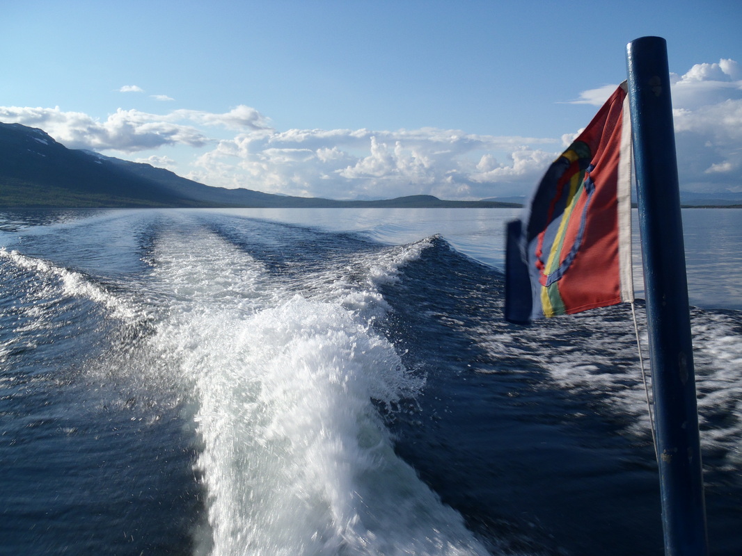
I went back again to the 'vitagronabandet' website and checked the rules again. I was relieved to see that using 'Sami' boats such as Chris did is permitted. The prices have risen somewhat and the enterprising Samis will get you over for about 200 to 300 kronor (about £20 to £30). Costs could mount so I might make use of the rowing boats on smaller sections. Trying to get hold of someone to take you over could be a problem at times. The busier sections of the Kungsleden from Kvikkjokk north have typically a scheduled departure once a day in high season. The boat journeys are fun. This summer I crossed over to 'Vaisa' on one to pick up the 'trailhead' of 'Padjelantaleden' and enjoyed the splendid sight of Mount Akka rising up from the other side. My pictures below perhaps show how pleasant that was. To note though only two hours before the wind had whipped up the same lake into a frenzy and being caught out in it would be frightening.


Picture
So, I note Chris' words and will think carefully about crossing the big lakes. I must admit I am spending a little bit of time on the rowing machine in the gym as preparation. Waiting a day for a boat may throw my schedule out but again being caught out in bad weather could put a very sudden end to a long walk!

Picture
Forward>>

    Archives

    July 2017
    June 2017
    April 2017
    March 2017
    December 2016
    November 2016
    October 2016
    August 2016
    July 2016
    June 2016
    April 2016
    December 2015
    November 2015
    August 2015
    July 2015
    June 2015
    March 2015
    January 2015
    December 2014
    November 2014
    October 2014
    September 2014
    August 2014
    July 2014
    June 2014
    May 2014
    April 2014
    March 2014
    February 2014
    January 2014
    December 2013
    November 2013
    October 2013
    September 2013
    August 2013
    July 2013
    June 2013
    May 2013
    April 2013
    March 2013
    February 2013
    January 2013
    December 2012
    November 2012
    October 2012

Proudly powered by Weebly
  • My Blog
    • About Me